
This article is written by Jennifer Cooper, Landscape Architecture Bureau Manager at San Francisco Public Works. This article is one of the entrants in Apolitical's 2020 American public servant writing competition.
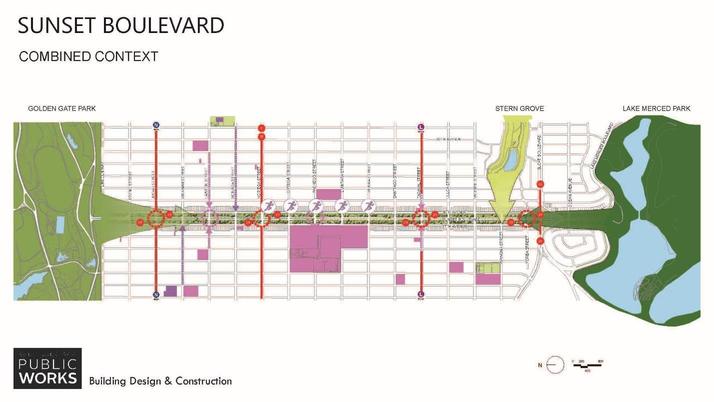
If you’re looking at San Francisco from a bird’s eye view, one of the first things you’ll notice is how Sunset Boulevard strikes a clear green line between Golden Gate Park and Lake Merced.
This two-mile-long stretch of wide planted medians, which in the 1930s cut through the surrounding sand dunes, was once a grander civic boulevard of green lawn and picturesque but non-native Monterrey Cypress.
The boulevard remained unchanged until the California drought from 2011 to 2014, when the irrigation system had to be turned off to conserve water. The once lush lawns became “golden” and the adjacent community was disappointed by the change in their premier local green spaces.
But simply turning the water back on knowing that severe droughts would become even more common was not a responsible use of public resources. Climate change is exaggerating extremes in weather across the globe and California’s Mediterranean climate of winter rain, summer droughts, and wildfires will become even more extreme.
So, we need to be prepared for managing the increased rain using stormwater management and surviving dry periods using drought-tolerant plantings. Climate change also is creating challenges for native species, who evolved along with California’s unique climate and are finding fewer places to thrive in our cities.
Bioblitzing
Beginning in 2019, our assignment at the Landscape Architecture Bureau at San Francisco Public Works was to create a drought-tolerant masterplan for the boulevard.
A process to connect greywater, (wastewater from combined sources that has been treated to a tertiary standard instead of potable), was already underway, so there would be access to irrigation. But the department knew that a more drought-tolerant planting palette was still the right thing to do.
So, this being San Francisco, we decided to harness technology and environmentally passionate volunteers using a bioblitz
During this time, multiple reports including findings from the United Nations-backed panel, Intergovernmental Science-Policy Platform on Biodiversity and Ecosystem Services (IPBES), highlighted a massive decline in insects and animal species worldwide. As a part of the world biodiversity hotspot of the California Floristic Province, San Francisco needed to do its part to increase biodiversity.
The City’s Board of Supervisors passed the San Francisco Biodiversity Resolution in April 2018 expressing its commitment.
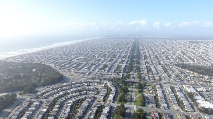 Aerial view of San Francisco's Sunset District from drone. Source Wikipedia
In response, our team quickly focused on the project as a biodiversity masterplan.
We worked with local experts, including the California Native Plant Society, Presidio Trust, SF Dept. of the Environment, and the Natural Resources Group from the San Francisco Recreation and Park Department to share knowledge and best practices for a robust planting palette that would thrive along the corridor’s sandy soils and windswept environment.
How would we measure success? We did not have any data on the current biodiversity of the site, although we could assume with mostly lawn and a small number of tree species, the diversity was likely limited. So, this being San Francisco, we decided to harness technology and environmentally passionate volunteers using a bioblitz.
A bioblitz is a focused cataloguing of as many species as possible at a given time and location by a group of experts or volunteers.
We utilized an app called iNaturalist developed through the California Academy of Sciences. All the data on the platform is open source and can be added to by anyone in the community. So, on a summer day, thirty volunteers split into two groups and started at either end of the boulevard working towards a meeting point in the middle.
They catalogued plants, small mammals, salamanders, birds, butterflies, and insects. Everyone had a fun day, especially the children who were enthralled by the small creatures we discovered under rocks and logs.
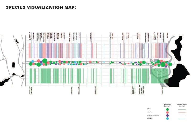 Data visualization showing distribution of species found during the bioblitz. Graphic by Public Works intern, Tara Singh.
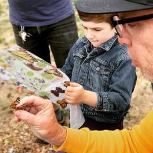 Young naturalist learns about butterflies
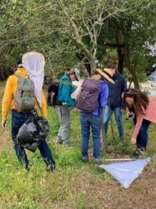 Cal Academy team assists using butterfly nets and “beat sheets.”
The great thing about using iNaturalist is that it can be added to at any time by anyone. This continues to keep the community engaged as we collaborate with environmental and community groups, and schools to increase data collection in different weather and times of year.
Implementation
As we begin Phase One, this technology and community engagement will allow us to chart the progress of the project and have quantifiable results. We will report back each year on new species that the native landscape has attracted.
The landscape team followed up with multiple community meetings and design iterations with a focus on native San Francisco plant species well suited to the coastal environment. In response to community feedback we were able to incorporate small areas of lawn for recreation and dog use, as well as ample space for native species and habitat.
We would encourage other cities to incorporate a similar multilayered approach to public open space and right-of-way design that includes habitat, stormwater, recreation and open space. Robust engagement of the community as community scientists also should be prioritized to both educate the public and generate support.
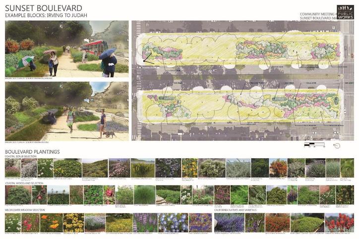 Community engagement boards by Public Works designers Jennifer Brooks, Solange Guillaume, and Jennifer Cooper.
As the designers and owners of the right of way, which is the areas adjacent to the roads, the team had a vested interest in designing with maintenance in mind. We designed the pilot blocks as three different landscape typologies:
- Lawn: Requires more frequent irrigation and mowing. Native and “no-mow” varieties are being considered.
- Native Meadow: Seeded areas of wildflowers, which need little water and only need to be mowed once annually. Sheet mulching has been used in test plots to great success in suppressing existing weeds.
- Native Coastal Scrub: Combination of native shrubs and perennials. It only requires water for establishment and never needs to be mowed. Will require more maintenance initially to control weeds while shrubs mature but will require less maintenance over the long term.
Partnering for wildlife
An integrated native planting approach and community engagement program such as this are often thought to be more expensive to design and maintain. We would like to emphasize that this is not necessarily the case.
Any masterplan planting design would have required research, careful plant selection, design, and community engagement. The amount of additional time required to solicit feedback from experts and engage in the bioblitz was minuscule in comparison to the potential impact on water use, maintenance costs, biodiversity and habitat.
Community science efforts like the bioblitz are also very affordable to organize and can continue to provide additional data. What we learned through this process is that it is important to have the right partners who are knowledgeable about what wildlife might be found in the area. Our partnership with the California Academy of Sciences was invaluable and made it a much more educational experience for everyone. We also have only done one organized bioblitz in the summer, but it would be even more useful to do one in each season to get a broader understanding of the wildlife during different seasons.
For data analysis, setting up a digital boundary around the site is critical to being able to pull the same dataset easily at any time. While this may sound complex, it was actually easy to set up using clear tutorials on the iNaturalist website. We would highly recommend this approach in other cities and would be happy to share resources and results as the project progresses. We look forward to a more robust and biodiverse Sunset Boulevard! — Jennifer Cooper
(Picture credit: Unsplash)
Make sure to share your own thoughts with the author by leaving a comment below

Log in or sign up to continue the conversation